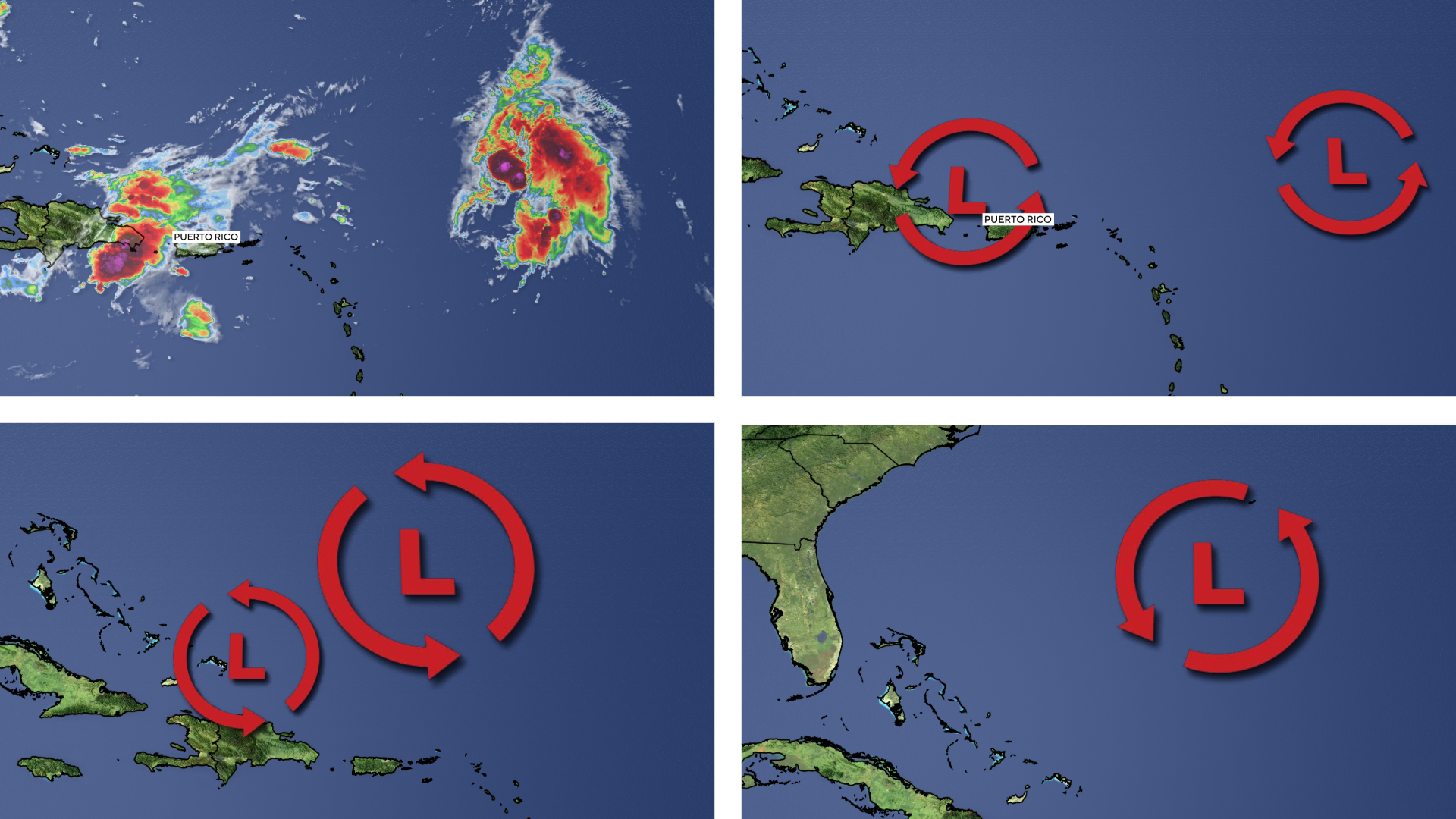
Tropical Storm Humberto, the eighth named storm to emerge this hurricane season, is currently swirling over waters just north of the Caribbean. Although forecasts as of Thursday predict that Humberto won’t ever touch land, there is a possibility it could interact with another system developing nearby in the western Atlantic.
How the process plays out depends on the characteristics of the storms involved, according to the National Weather Service. The forecasting agency describes the Fujiwhara effect on its website as “an intense dance” between two tropical storms that can happen when they get close enough to each other on their respective tracks to reach a common point and either join together or spin around each other for a period of time before continuing along their individual paths.
Nikki Nolan/CBS News
In the latter scenario, the storms involved must be comparably strong or large.
“Typically when one system is stronger than the other, the smaller and weaker system will get overrun by the larger, stronger one and completely eliminates it,” Nolan said.
Similar systems “will dance around each other” before going their separate ways, she continued, adding: “Very rarely has a larger system absorbed a smaller one and become larger or stronger, but it is scientifically possible.”
Humberto grew into a tropical storm Wednesday night while traveling over open waters in the central tropical Atlantic. Forecasters expect it to move northwest over the next few days and strengthen along the way, the National Hurricane Center said in an advisory. It’s one of two systems in the region that could potentially impact parts of the southeastern United States, including coastal areas from Florida to North Carolina, according to Michael Brennan, director of the hurricane center.
Officials at the center said Wednesday that they were monitoring a second storm churning near Humberto over the northeastern Caribbean, which would likely become a tropical depression later in the week and a tropical storm, named Imelda, over the weekend. That system is expected to strengthen as it tracks toward the Bahamas — driving up the chances of storm surge, wind and rainfall striking coastal parts of the southeastern U.S.
“With the two tropical troubles currently north of the Caribbean, these two may interact under the Fujiwhara effect in the days ahead,” said Nolan. However, because the developing system “appears to be much weaker than Humberto and several miles away from it,” an interaction between the two — if one even takes place at all — may not result in a tangled gravitational “dance.”
In the event Humberto and the second system do collide, it’s possible the paths they’re expected to travel will change, Nolan added, but only slightly.
The National Hurricane Center said in an advisory Thursday morning that Humberto was on its way toward becoming a hurricane within a day or so over the central Atlantic. At the time, the storm was located about 465 miles east-northeast of the northern Leeward Islands and had maximum sustained winds of 50 miles per hour.
Nikki Nolan
contributed to this report.


